Preparing the Data
Georeferencing
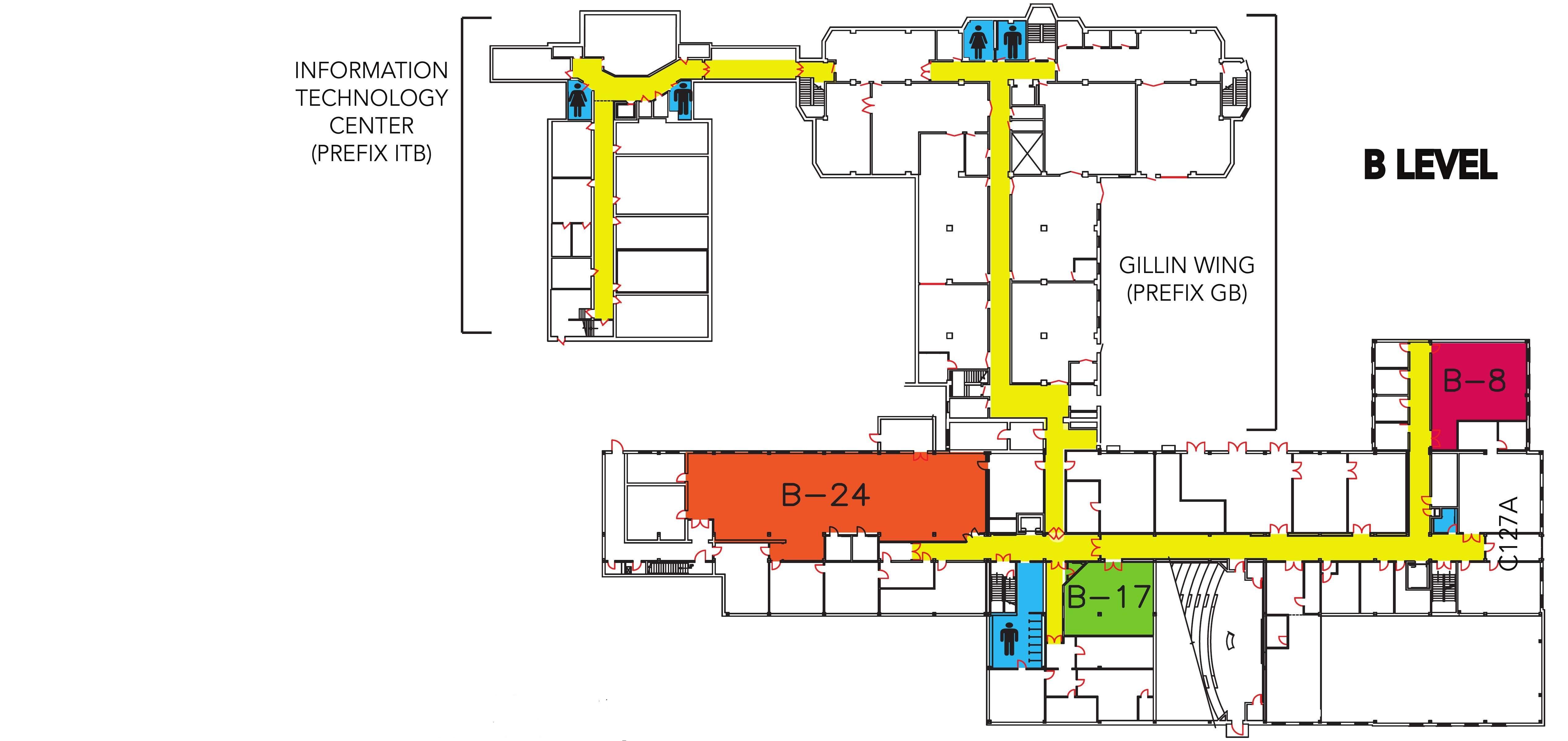
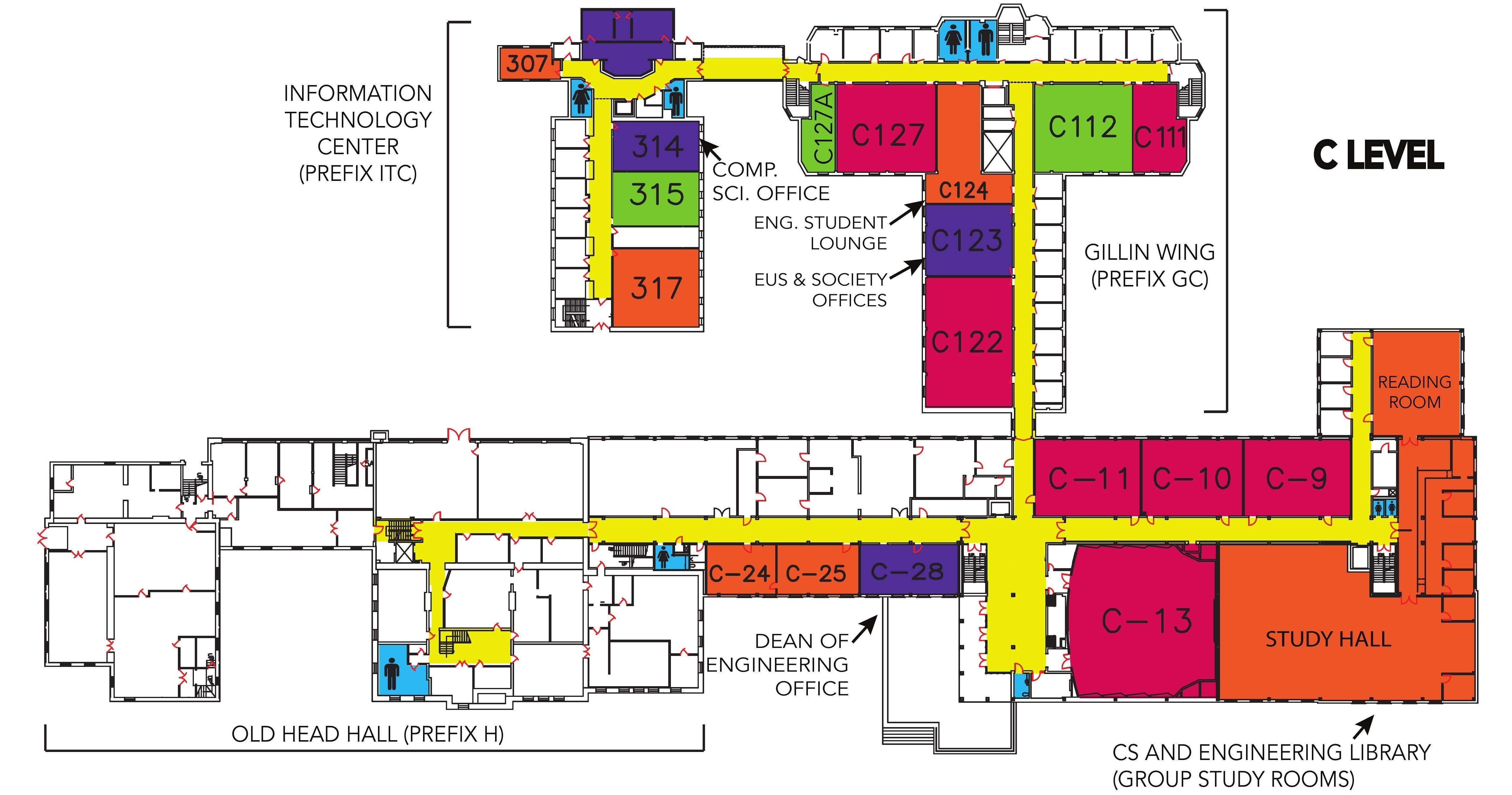
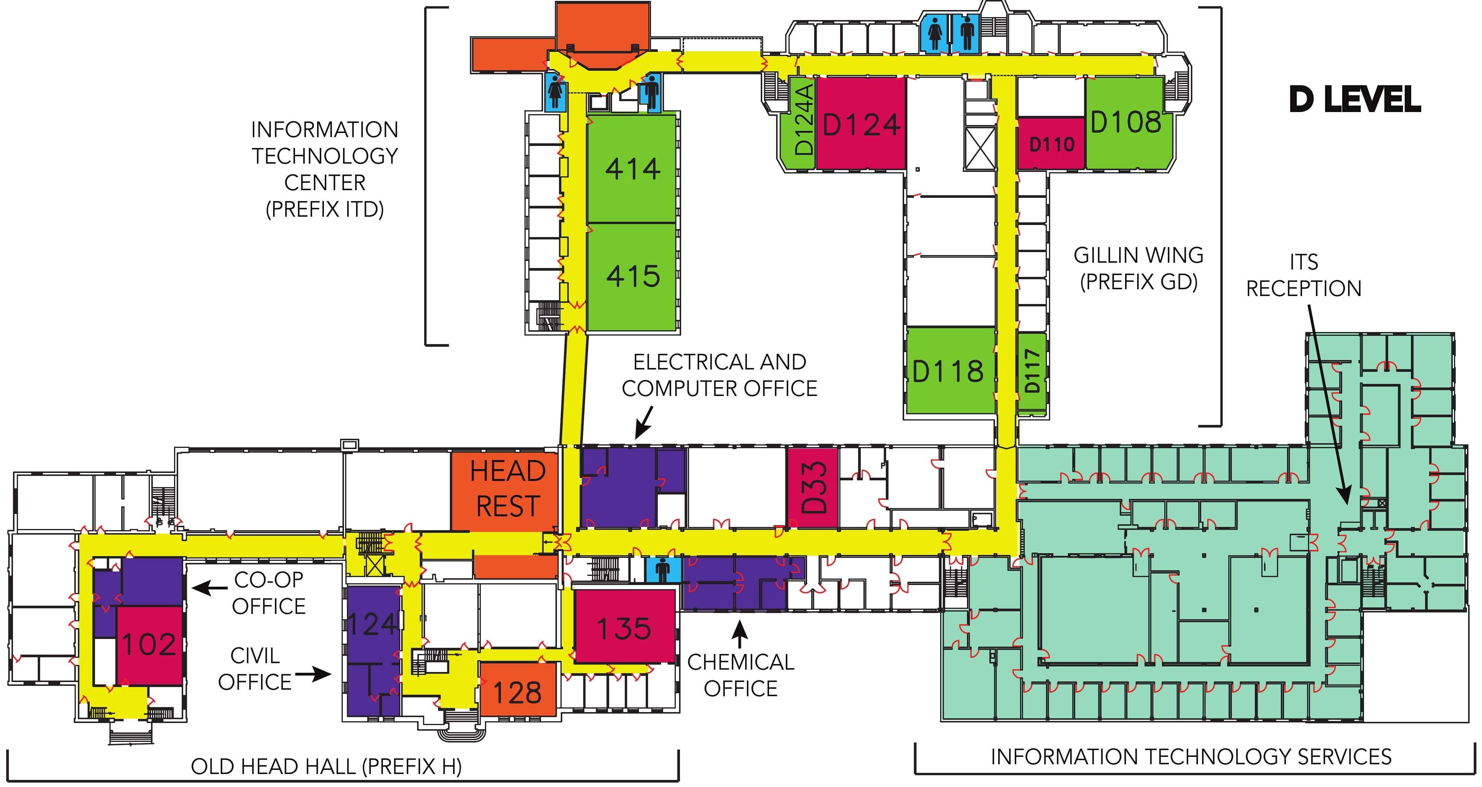
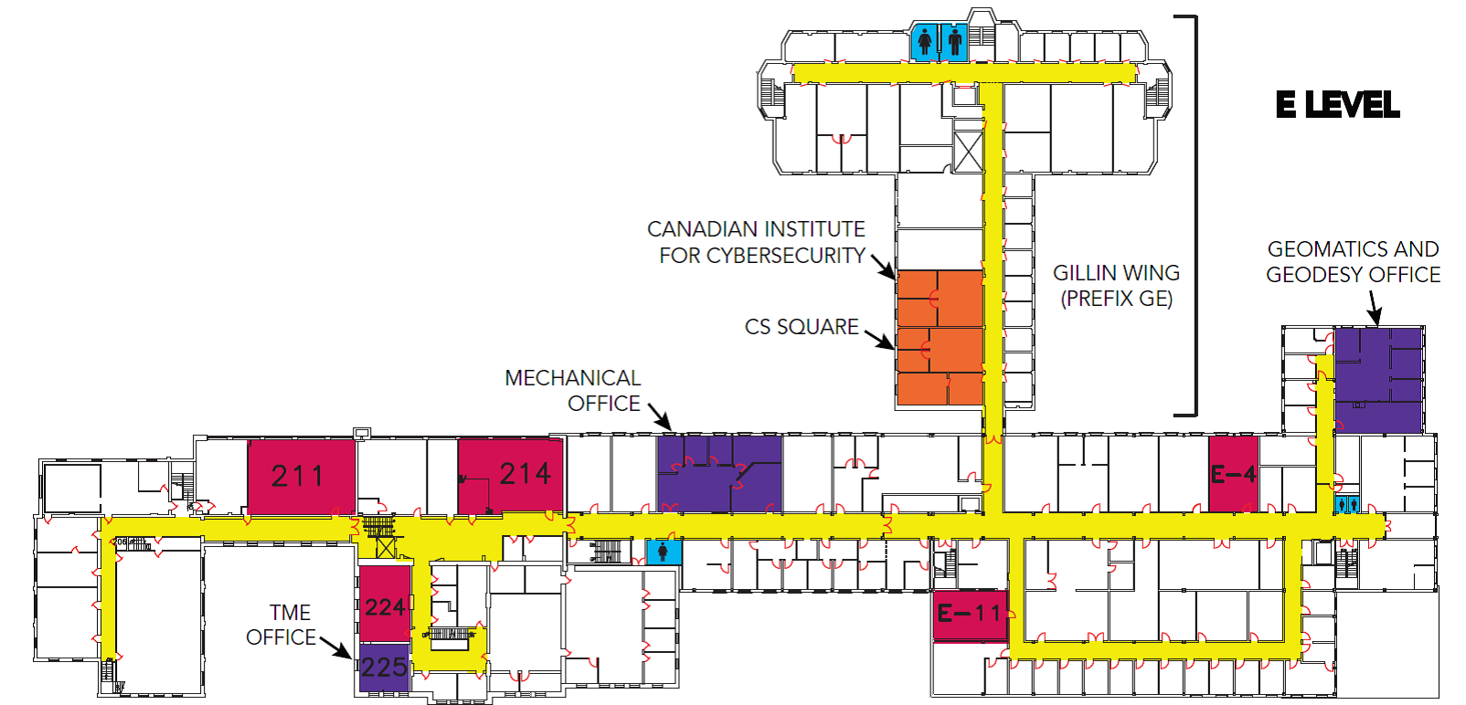
Floor plan images were georeferenced so that shape files for blocks, route and points can be created. For this purpose, gdal_translate command was used
gdal_translate -of GTiff -a_ullr 0 90 180 0 -a_srs EPSG:4326 x_Level.jpg x_Level.tiff
Creating Shape Files
Polygons
Georeferenced tiff images were loaded into ArcGIS and blocks (Polygons) were created for each rooms.
Lines
Line (route) network is created for the whole plan.
Points
Using ArcGIS’s snapping tool, points for each block (polygon) were placed on the line network created. These points can be thought of as NODES.
Converting Shape files to EDGES
Using ArcGIS’s Feature to Line tool separate edges were created. Basic elements for routing (nodes and edges) were prepared now.
Attribute tables

Table schema for Blocks shapefile
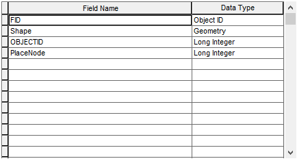
Table schema for Places shapefile
Corresponding description are filled in their own columns in blocks and places shapefiles. Both shapefiles have one attribute in common which is PlaceNode. For every block, there should be a point in the network with same PlaceNodes. This is useful when a <keyword> is given for searching, its corresponding point can be found with the help of this PlaceNode attribute and the network can be queried for the route.